9 Days Tour

9 Days 8 Nights
Airport | Negombo | Dambulla | Habarana | Polonnaruwa | Habarana | Matale | Kandy | Tea Plantation | Nuwara Eliya | Yala | Thissamaharamaya | Galle | Bentota | Kosgoda | Airport

>>| Booking |<<

1st Day ⊡ Airport | Negombo

Negombo is a city on the west coast of Sri Lanka, north of the capital, Colombo. Near the waterfront, the remains of the 17th-century Dutch Fort now house a prison. Negombo Lagoon, lined with fishermen’s huts, feeds into the Dutch-era Hamilton Canal. The canal leads south to Colombo. Neoclassical St. Mary’s Church, completed in the 1920s, features a ceiling decorated with vivid religious paintings.

2nd Day ⊡ Negombo | Dambulla | Habarana

Dambulla cave temple is a world heritage site, declared by UNESCO in 1991. The Dambulla rock cave temples’ history dates back to the 2nd century BC. During the reign of King Sadda Tissa, the monastery was donated to the monks for dwelling and meditating. In 1st century BC in the reign of King Valagamba of Anuradhapura Kingdom, there were 7 invaders of Anuradhapura. Dambulla is the largest and best-preserved cave temple complex in Sri Lanka. The rock towers 160m over the surrounding plains and there are more than 80 documented caves in the surrounding area. There are five major caves, which contain statues and paintings. These paintings and statues are related to Gautama Buddha and his life. There are 153 Buddha statues, three statues of Sri Lankan kings and four statues of gods and goddesses. As you enter the retreat, look straight up to the gigantic Buddha statue glittering in gold over land, which today houses an important junction in the country's economic and cultural uplifting.

A World Heritage Site Sigiriya is an ancient rock fortress located in the northern Matale District near the town of Dambulla in the Central Province, Sri Lanka. According to the ancient Sri Lankan chronicle the Culavamsa, this site was selected by King Kasyapa (477 – 495 CE) for his new capital. He built his palace on the top of this rock and decorated its sides with colourful frescoes. The capital and the royal palace was abandoned after the king's death. It was used as a Buddhist monastery until the 14th century.

3 rd Day ⊡ Habarana | Polonnaruwa | Habarana

Minneriya National Park is a national park in North Central Province of Sri Lanka. The tank is of historical importance, having been built by King Mahasen in third century AD. The park is a dry season feeding ground for the elephant population dwelling in forests of Matale, Polonnaruwa, and Trincomalee districts. Minneriya forms one of the 70 Important Bird Areas (IBAs) of Sri Lanka.

Polonnaruwa which was the 2nd capital city fo Sri Lanka built in the 11th and 12th centuries AD, and which is a world heritage site. Blessed by stupas resting Buddha statues , irrigation canals and fantastically carved hindu sculptures - while observing the relic house - Watadage - which boasts fo beautifull stone carving . Take a close glance and you will realize a subtle hindu influence on architecture and statues found in polonnaruwa.

4 rd Day ⊡ Habarana | Matale | Kandy

Matale is the largest town of Matale District of the Central Province, of Sri Lanka. It is 142 kilometres (88 mi) from Colombo and near Kandy. Surrounding the town are the Knuckles Mountain Range, the foothills were called Wiltshire by the British. It is a mainly agricultural area, where tea, rubber, vegetable and spice cultivation dominate.Visit a spice garden in Matale to see many different types of spices Sri Lanka is famous for. Just 25 km from the hill capital of Kandy, the Matale spice gardens are among the best on the island. You will be introduced to different spices and shown how some of these spices are grown and processed.

5 th Day ⊡ Kandy | Nuwara Eliya | Ella

Nuwara Eliya is a city in the hill country of the Central Province, Sri Lanka. Its name means "city on the plain " or "city of light". The city is the administrative capital of Nuwara Eliya District, with a picturesque landscape and temperate climate. The elevation is 1868m(6128ft) above from the sea level. Then for it has a subtropical climate, The city attracts many tourists around the world. And as well as Srilankans, even during the colonial period of the british 19th 20th centuries. This was the plase were the British officers came for the recreational works. Such as play golf, cricket, hunting and many more. There for even today we can see witness many colonial buildings in the surrounding and the Nuwara Eliya referred as little England.

6 th Day ⊡ Nuwara Eliya | Yala | Thissamaharama

Ella is a small town in the Badulla District of Uva Province, Sri Lanka governed by an Urban Council. It is approximately 200 kilometres (120 mi) east of Colombo and is situated at an elevation of 1,041 metres (3,415 ft) above sea level. The area has a rich bio-diversity, dense with numerous varieties of flora and fauna. Ella is surrounded by hills covered with cloud forests and tea plantations. The town has a cooler climate than surrounding lowlands, due to its elevation.Specially the Ella is regarded as one one of the most beautiful place in Sri Lanka. It is most popular for the hikes. The Little Adam's Peak and Ella Rock are one of the most popular hiking places in Ella. Ella rock hiking is bit more difficult and complicated to visit compared with Little Adam's peak. The Nine Arch bridge is probably the most iconic sight in all of Ella. The beautiful stones and bricks structure also called the Bridge in the sky. It is one of the best examples of colonial-era railway construction in the country. The Ella Gap allows views across the southern plains of Sri Lanka.

Yala National Park is the most visited and second largest national park in Sri Lanka, bordering the Indian Ocean. The park consists of five blocks, two of which are now open to the public, and also adjoining parks. The blocks have individual names such as, Ruhuna National Park , and Kumana National Park or 'Yala East' for the adjoining area.The park covers 979 square kilometres. The park is best known for its variety of wild animals. It is important for the conservation of Sri Lankan elephants, Sri Lankan leopards and aquatic birds.

7 th Day ⊡ Thissamaharama | Galle | Bentota

Galle is a major city in Sri Lanka, situated on the southwestern tip, 119 km from Colombo. Before the arrival of the Portuguese in the 16th century, when it was the main port on the island. Galle is the best example of a fortified city built by the Portuguese in South and Southeast Asia, showing the interaction between Portuguese architectural styles and native traditions.The Galle fort is a world heritage site in Asia.

8 th Day ⊡ Bentota | Kosgoda | Bentota

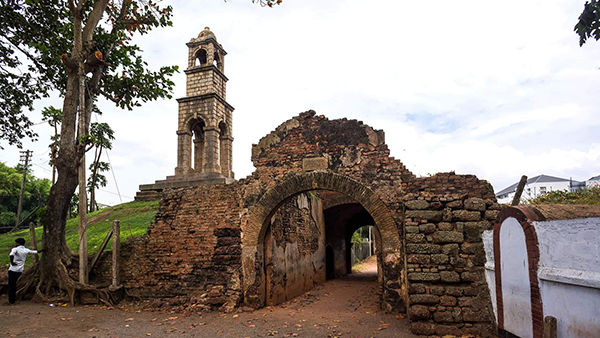
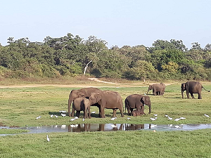
Balapitiya is a coastal town, in south west Sri Lanka. The most important asset of the fragile eco-system of Madu River is its mangrove forests. These mangrove forests are providing protection for a large number of aquatic bird, animal and plant species. The eco-system in Madu River is the home for different kinds of aquatic plants, crabs, shrimps, fish, insects, amphibians and other animal life including crocodiles. Madu River is inhabited by a large number of animals and its bio-diversity is at very high level. This ecological complex is a Ramsar wetland and it is the second largest wetland on the island. 28 islands (some of them are inhabited by humans) are included in the Madu River estuary. The extent of the Madu River wetland is 915 hectares and harbours multi-varied Bio-diversity Eco-systems. There is no road network connecting the island and mainland and the boat is the main source of transport for the people living on the islands. The Kotduwa Buddhist temple occupies an island and it is the main religious institution for the people, who live on Madu River. Kothduwa temple is an important tourist attraction and visited by many tourists, who undertake the Madu River safari. Madu River is one of the best places to witness the different types of mangroves in the country.

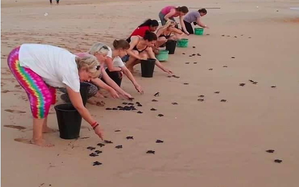
The Turtle Care Centre at Kosgoda beach is one of 18 turtle hatcheries along the southern coast of Sri Lanka. The centre is located in the South Western coastal village of Kosgoda and was establised in 1981. It is also very popular as all five species of turtles that visit Sri Lanka nest in Kosgoda. This is not so with many of the other hatcheries around the island whose beaches host only some of the species.

Bentota is a coastal town in Sri Lanka, located in the Galle District of the Southern Province, governed by an Urban Council. It is approximately 65 kilometres (40 mi) south of Colombo and 56 kilometres (35 mi) north of Galle. Bentota is situated on the southern bank of the Bentota River mouth, at an elevation of 3 metres (9.8 ft) above the sea level. The name of the town is derived from a mythical story which claims a demon named 'Bem' ruled the tota or river bank.


Transfer Form Colombo To Ariport For Departure